Cold Front Coming After Rain: Here's How Cool It Could Get In The Northeast This Weekend Cold Front Coming After Rain: Here's How Cool It Could Get In The Northeast This Weekend Cold Front Coming After Rain: Here's How Cool It Could Get In The Northeast This Weekend
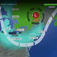
Cold Front Coming After Rain: Here's How Cool It Could Get In The Northeast This Weekend Break out those jean jackets. After a day of rain, temps are expected to drop for a classic fall day in the Northeast, forecasters say. Saturday, Sept. 7 will be rainy with a high of 75 and showers on the lighter side with the exception of a few thunderstorms, according to the National Weather Service. AccuWeather says the rain will fall during the first part of the weekend. Unsettled weather today due to some showers and perhaps a few thunderstorms. Rainfall amounts expected to be on the... Posted by US National Weather Service Philadelphia/Mount Holly on Saturday, September 7, 20…
Your Labor Day Weekend Forecast: Expect Sporadic Storms Before Sunny Skies Your Labor Day Weekend Forecast: Expect Sporadic Storms Before Sunny Skies Your Labor Day Weekend Forecast: Expect Sporadic Storms Before Sunny Skies
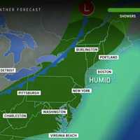
Your Labor Day Weekend Forecast: Expect Sporadic Storms Before Sunny Skies The last few days of summer are upon us. Here's how the weather patterns will play out Labor Day Weekend in the Northeast. The National Weather Service says Saturday, Aug. 31 will be mostly cloudy with scattered showers and thunderstorms possible around 6 p.m.  "Humidity levels will build ahead of that front on Saturday and as that occurs, the risk of showers and thunderstorms will increase," AccuWeather says. For western MD, eastern WV, and NW Virginia, scattered severe thunderstorms are expected this afternoon. They could... Posted by US National Weather Service Baltimore/Washin…
Severe Thunderstorms May Bring Ping Pong-Sized Hail, 70 MPH Wind Gusts To DMV Region Severe Thunderstorms May Bring Ping Pong-Sized Hail, 70 MPH Wind Gusts To DMV Region Severe Thunderstorms May Bring Ping Pong-Sized Hail, 70 MPH Wind Gusts To DMV Region
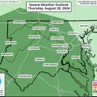
Severe Thunderstorms May Bring Ping Pong-Sized Hail, 70 MPH Wind Gusts To DMV Region A Severe Thunderstorm Watch has been issued for parts of the DMV region as wicked weather is expected to roll through the region, forecasters are cautioning. Following a sweltering day, the National Weather Service is advising that parts of DC, Maryland, and Virginia may be subject to storms that may bring whipping winds approaching 70 mph and ping pong-sized hail to some areas. The Watch has been issued throughout the region through 11 p.m. on Thursday, Aug. 29. A Severe Thunderstorm Watch has been issued for areas along and west of the DC metro area until 11 PM tonight. The primary th…
Scorching Heat, Severe Storms: Your Forecast Leading Up To Labor Day In NJ, PA Scorching Heat, Severe Storms: Your Forecast Leading Up To Labor Day In NJ, PA Scorching Heat, Severe Storms: Your Forecast Leading Up To Labor Day In NJ, PA
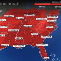
Scorching Heat, Severe Storms: Your Forecast Leading Up To Labor Day In NJ, PA The heat is going to ramp up before summer winds down in the Northeast. Heat advisories, warnings, and watches are in place this week across New Jersey and Pennsylvania as temperatures climb up to the high 90s, even feeling close to 100 degrees in some places, AccuWeather and the National Weather Service report. Tuesday, Aug. 27 is sunny with a high of 89 while Wednesday, Aug. 28 will be as hot as 97 degrees, the NWS said. According to AccuWeather, Real Feel temps could creep into the 90s on Tuesday, and up to 105 Wednesday. A heat advisory was in effect through 8 p.m. Wednesday for Bergen…
String Of Storms Could Develop As Height Of Hurricane Season Nears - Here's Timing: AccuWeather String Of Storms Could Develop As Height Of Hurricane Season Nears - Here's Timing: AccuWeather String Of Storms Could Develop As Height Of Hurricane Season Nears - Here's Timing: AccuWeather
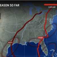
String Of Storms Could Develop As Height Of Hurricane Season Nears - Here's Timing: AccuWeather A newly released forecast predicts between six to 10 named storms through the end of September. “We could see a parade of storms developing during September," AccuWeather Lead Hurricane Expert Alex DaSilva. "There’s a possibility that we could see multiple tropical storms and hurricanes in the Atlantic basin on the same day, similar to the frequency of storms we’ve seen during other supercharged hurricane seasons like 2020." The 2024 hurricane season, which began Saturday, Jun 1, runs through Saturday, Nov 30. The statistical peak of the hurricane season is traditionally around the mi…
New Update: Here's Timing For Next Storm Chance After Precipitation-Free Days New Update: Here's Timing For Next Storm Chance After Precipitation-Free Days New Update: Here's Timing For Next Storm Chance After Precipitation-Free Days
New Update: Here's Timing For Next Storm Chance After Precipitation-Free Days A return of more humid air will fuel a new round of thunderstorms after a days-long stretch of dry, comfortable weather.The timing for the storm system is from late in the afternoon into the evening on Monday, Aug. 26. It will remain precipitation free through the weekend. The mercury will get higher on Saturday, Aug. 24, and Sunday, Aug. 25, with temps in the mid-80s, and mainly sunny skies both days, the National Weather Service says. Humidity will increase on both Sunday and Monday. Monday's high temperature will be in the low 80s. "Over the weekend, humidity levels will probably be ba…
Weekend Storms To Douse Parts Of DC, Maryland, Virginia: Forecasters Weekend Storms To Douse Parts Of DC, Maryland, Virginia: Forecasters Weekend Storms To Douse Parts Of DC, Maryland, Virginia: Forecasters
Weekend Storms To Douse Parts Of DC, Maryland, Virginia: Forecasters Some severe weather may be coming to parts of Maryland and Virginia following the recent spell of dry conditions throughout the region, forecasters say. What started as a pleasant weekend in the DMV is going to be doused by rain as storms move into the area, with the possibility of severe weather on Saturday leading into Sunday. Numerous showers and thunderstorms are expected today with a risk of some severe weather and flash flooding. #DCwx #MDwx #VAwx #WVwx pic.twitter.com/mqhnVnNlae — NWS Baltimore-Washington (@NWS_BaltWash) August 17, 2024 The most intense weather is expected to co…
Thunderstorms Possible For NJ, PA This Weekend But 'Not Total Washout,' Forecasters Say Thunderstorms Possible For NJ, PA This Weekend But 'Not Total Washout,' Forecasters Say Thunderstorms Possible For NJ, PA This Weekend But 'Not Total Washout,' Forecasters Say
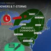
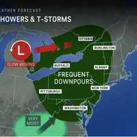
Thunderstorms Possible For NJ, PA This Weekend But 'Not Total Washout,' Forecasters Say A slow-moving eastward storm system means a chance of rain and thunderstorms this weekend across New Jersey and Pennsylvania. Accuweather says that a "total washout" is not likely in the east. This weekend turns unsettled as showers and some t-storms increase at times, especially each afternoon and evening. High... Posted by US National Weather Service Philadelphia/Mount Holly on Friday, August 16, 2024 However, "there will be enough rain and thunderstorms around to interfere with some outdoor plans, as well as slow travel and perhaps create dangerous conditions in some locations."…
Tornado Watch Now Issued In Bergen County As Debby Creeps In Tornado Watch Now Issued In Bergen County As Debby Creeps In Tornado Watch Now Issued In Bergen County As Debby Creeps In
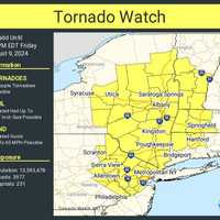
Tornado Watch Now Issued In Bergen County As Debby Creeps In The National Weather Service has shifted its tornado watch across New Jersey and Pennsylvania as Hurricane Debby creeps in. In New Jersey, the tornado watch is in effect through 10 p.m. Friday, Aug. 9 and covers Bergen, Essex, Hunterdon, Mercer, Middlesex, Morris, Passaic, Somerset, Sussex, Union and Warren counties in North Jersey. In Pennsylvania, the tornado watch is issued in Lehigh, Northampton, Carbon, Monroe, and Bucks counties. The tornado threat for South Jersey has diminished since the initial watch was issued early Friday morning, which has since been canceled. AccuWeather Th…
Tornado Watch Issued In Parts Of DC, Maryland, Virginia Tornado Watch Issued In Parts Of DC, Maryland, Virginia Tornado Watch Issued In Parts Of DC, Maryland, Virginia
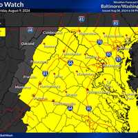
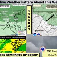
Tornado Watch Issued In Parts Of DC, Maryland, Virginia A Tornado Watch has been issued by the National Weather Service as Tropical Storm Debby continues to batter the DMV region.  Storms are expected to continue overnight, with upwards of four inches of rain possibly pouring in parts of the area, leading to increased risk of floods and "tropical downpours" as the storm continues to travel up the East Coast. The risk for flash flooding will continue to increase this evening and into the overnight hours. Rain amounts of 4-8" are possible along & west of the Blue Ridge with 2-4" further east. Remember if you see high water turn around …
Tracking Hurricane Debby: Tornadoes Pose Main Threat As Storm Takes Inland Path Tracking Hurricane Debby: Tornadoes Pose Main Threat As Storm Takes Inland Path Tracking Hurricane Debby: Tornadoes Pose Main Threat As Storm Takes Inland Path
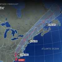
Tracking Hurricane Debby: Tornadoes Pose Main Threat As Storm Takes Inland Path The forecast track has shifted for Hurricane Debby, which is set to pass through northern Maryland and Pennsylvania, and drop torrential rain on surrounding areas late this week. The AccuWeather map shows that Debby's path has taken a westward shift, and is set to work its way through northern Maryland then Eastern Pennsylvania Friday, Aug. 9 into Saturday (after moving through the Carolinas Thursday, Aug. 8). Tornadoes are the main threat and severe thunderstorms are possible, the National Weather Service said. "A more inland track of the remnants of Debby places our r…
State Of Preparedness Declared In Maryland In Advance Of Tropical Storm Debby State Of Preparedness Declared In Maryland In Advance Of Tropical Storm Debby State Of Preparedness Declared In Maryland In Advance Of Tropical Storm Debby
State Of Preparedness Declared In Maryland In Advance Of Tropical Storm Debby Maryland Gov. Wes Moore has declared a State of Preparedness as possibly wicked weather continues to head toward the region with Tropical Storm Debby continuing to move north up the coast. On Tuesday, while acknowledging "the path is still uncertain," Moore cited "possible effects on Maryland could include heavy rain and winds, inland and tidal flooding," while making the declaration. During a State of Preparedness, officials say that is allows the state to enhance its ability to respond swiftly and effectively to potential hazards and threats in advance of an actual disaster. The ord…